Introduction:
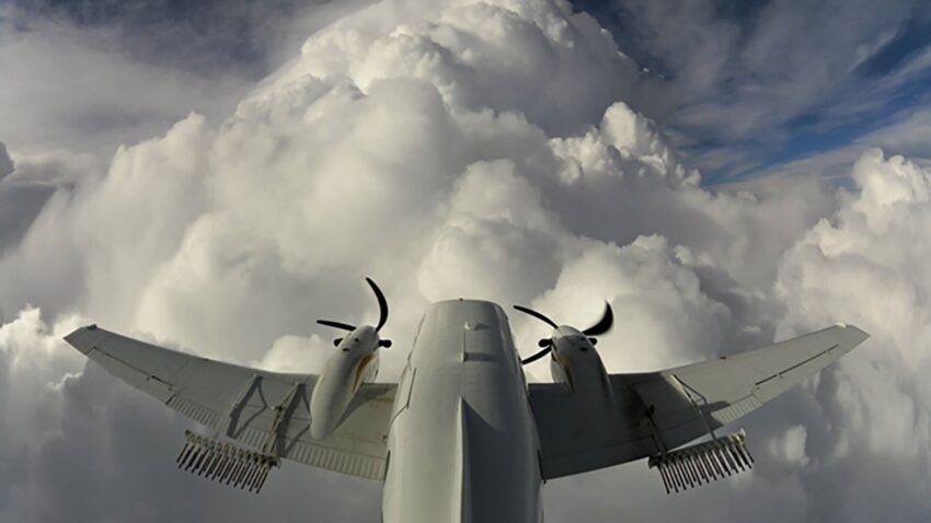
Clouds play a significant role in aviation as they impact weather conditions, flight operations, and overall flight safety. Pilots, air traffic controllers, and meteorologists rely on cloud classification systems to understand and communicate cloud formations accurately. In aviation, clouds are broadly categorized into ten main types, each exhibiting distinct characteristics and implications for aircraft operations. If you need more information, then visit cloud-based airport software.
This provides an overview of the different cloud types found in aviation and their significance in the context of flight operations.
1. Cumulus Clouds:
Cumulus clouds are perhaps the most recognizable cloud type, characterized by their fluffy, cotton-like appearance. These clouds develop vertically and have a flat base with rounded, cauliflower-shaped tops. Cumulus clouds are typically associated with fair weather conditions, especially when they appear in isolated or scattered formations. However, they can also grow into larger cumulonimbus clouds, which are associated with thunderstorms, turbulence, and heavy precipitation.
2. Stratus Clouds:
Stratus clouds are low-level clouds that form in a uniform, greyish layer, often covering the entire sky. They have a flat and featureless appearance, resembling a fog-like layer above the ground. Stratus clouds are associated with stable atmospheric conditions, and their presence often indicates overcast skies, reduced visibility, and the potential for drizzle or light precipitation. These clouds can sometimes lead to instrument flight rules (IFR) conditions, requiring pilots to rely solely on their instruments for navigation.
3. Cirrus Clouds:
Cirrus clouds are high-altitude clouds that appear as thin, wispy formations. They are composed of ice crystals and often have a feathery or hair-like appearance. Cirrus clouds are commonly found in fair weather conditions and are known as “mare’s tails” due to their wispy nature. While they generally pose no direct threat to flight operations, they can indicate the approach of a warm front or the presence of high-altitude winds, which may affect aircraft performance.
4. Stratocumulus Clouds:
Stratocumulus clouds are low-level clouds that form as a layer of lumpy, greyish clouds with defined edges. They often appear in a uniform pattern, covering large portions of the sky. Stratocumulus clouds are usually associated with stable weather conditions and can persist for extended periods. These clouds rarely produce significant precipitation but may lead to reduced visibility and low-level turbulence.
5. Altocumulus Clouds:
Altocumulus clouds are mid-level clouds that form as white or greyish patches or bands with a globular or wavy appearance. They are usually located at intermediate altitudes and can sometimes be layered or stacked. Altocumulus clouds often indicate instability in the atmosphere and can be a precursor to developing thunderstorms. However, on their own, they typically do not pose a significant threat to aviation operations.
6. Altostratus Clouds:
Altostratus clouds are mid-level clouds that form as a uniform, greyish layer covering large portions of the sky. They are thicker and denser than cirrostratus clouds but lack the distinct features of strati form rain clouds. Altostratus clouds often precede the arrival of a warm or occluded front, indicating the potential for prolonged periods of steady precipitation or drizzle. Pilots may encounter reduced visibility and deteriorating weather conditions when flying through or below altostratus clouds.
7. Cirrocumulus Clouds:
Cirrocumulus clouds are high-altitude clouds that appear as small, white patches or grains arranged in a regular pattern. They are often referred to as “mackerel sky” due to their resemblance to fish scales. Cirrocumulus clouds are composed of ice crystals and generally indicate fair weather conditions.
Conclusion:
However, we have learned of types of clouds are there in aviation.


Aimee Garcia is a Marketing Consultant and Technical Writer at DailyTechTime. She has 5+ years of experience in Digital Marketing. She has worked with different IT companies.

